With thew weather given in the morning I have the data I need to check on the "Cessna Performance Calculator"
Here we go


Here we go
I am good to go and I will use only 5600 feet of the 11000 available
Still I will have the Jepp FD apps open on my knee to see how far down the runway I am if we need to abord...for any reason...a blown tire a CAS message etc....
Then we check the satellite photo and it look a little ugly with a storm right on our route.
the weather form the tower looks great to the east, not to the south east where we are suppose to go
The red line is the Flight Plan path...on the group we are planning some deviation to avoid the worst part
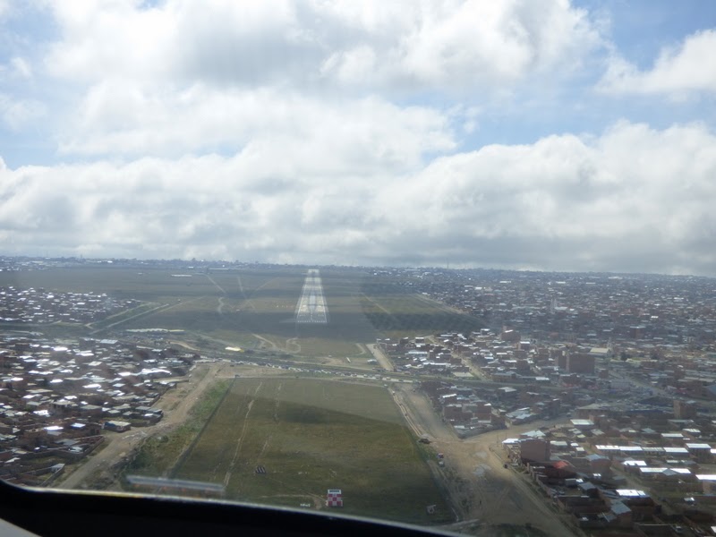
This is the real view...not as bad at what we saw on the satellite display
La Paz
The runway is where it is suppose to be
Fuel is waiting for us
La Paz, the highest commercial airport in the world
El Alto International Airport (Spanish: Aeropuerto Internacional El Alto) (IATA: LPB, ICAO: SLLP) is an international airport located 8 mi (13 km) south west of La Paz,[3] La Paz Department, Bolivia. Even with the higher altitude newly commercial airports built in China like Daocheng Yading Airport, Kangding Airport, etc.; El Alto is still the Highest International Airport in the world.[4]
The airport is located in the city of El Alto[5] and has served since the first half of the 20th century, but was modernized in the late 1960s, when its runway was lengthened and a new passenger terminal with modern facilities was built. The new airport was inaugurated in 1965.[6] El Alto airport was a primary hub for the former Lloyd Aéreo Boliviano, Bolivia's flag carrier which ceased operations in 2007 and is a hub for Transporte Aéreo Militar.[7] It serves also as a focus city for Boliviana de Aviación which is a state owned airline.
Never in my life of pilot, I would have creamed that one day I would be landing at the highest airport in the world...What an experience
But now we have to take-off again to Uyuni
No comments:
Post a Comment